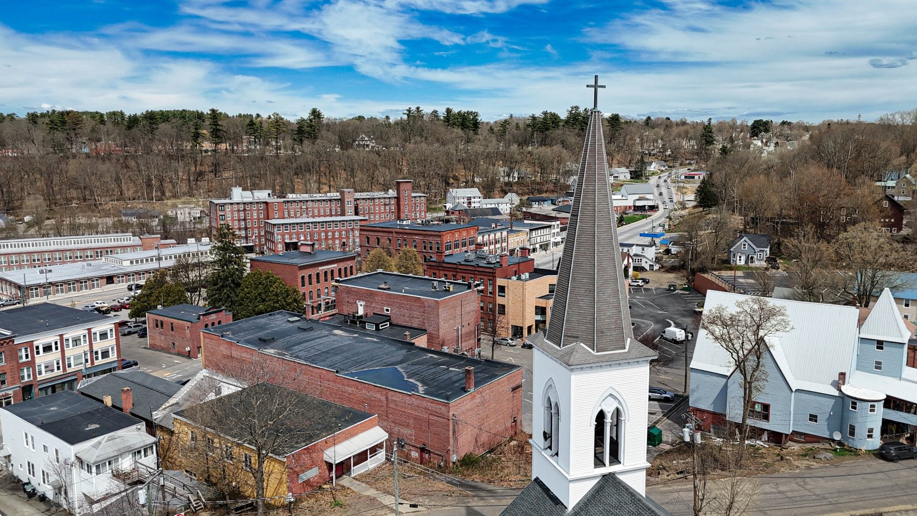
Steeple and Mill Blocks
Aerial view of Franklin’s steeple with mill buildings and downtown brickwork beyond.
View Print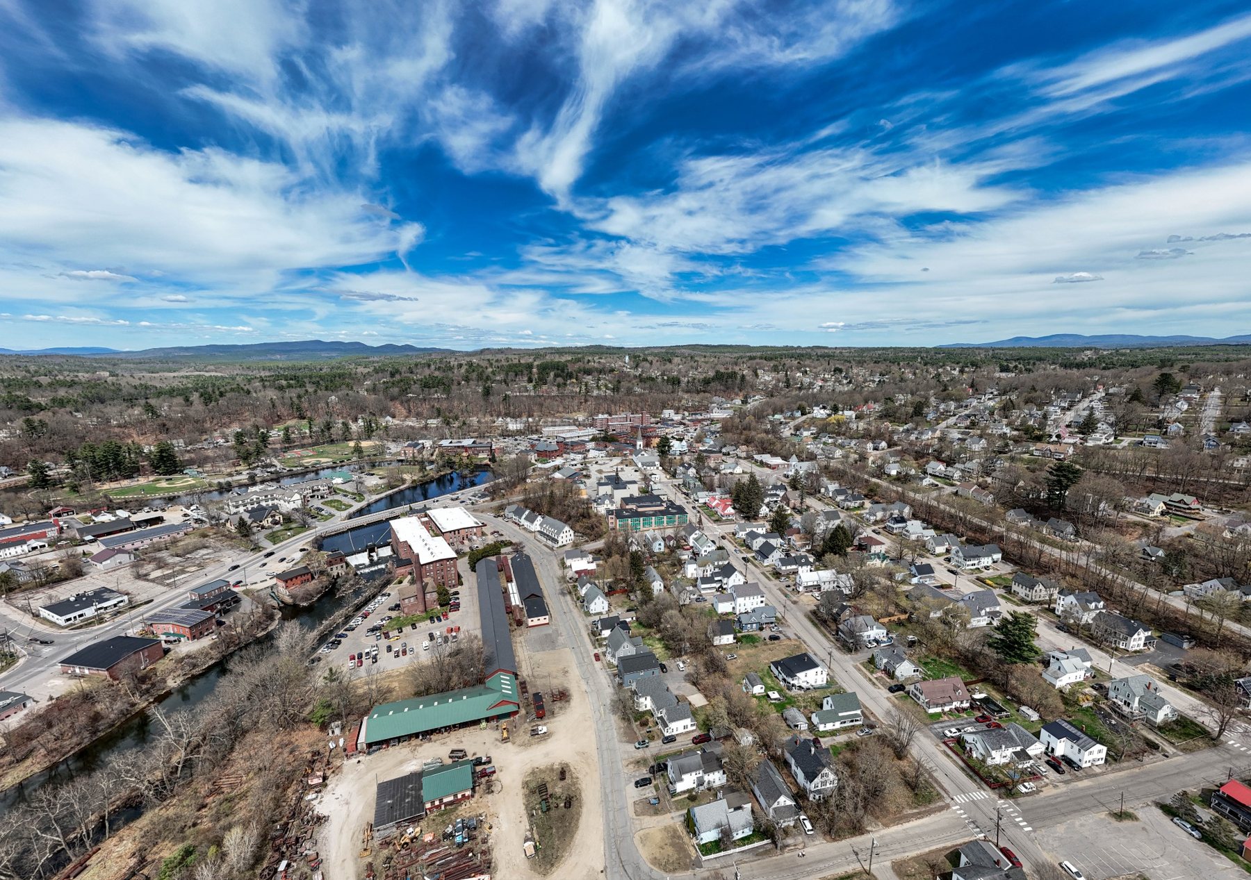
Merrimack County / Mill City
A river-and-mill city at the meeting of New Hampshire’s industrial past and modern downtown renewal, with church steeples, brick mill blocks, and dramatic skyline views.
Town Profile
A river-and-mill city at the meeting of New Hampshire’s industrial past and modern downtown renewal, with church steeples, brick mill blocks, and dramatic skyline views.
Part of Andri Kyrychok’s growing New Hampshire aerial town archive, this page is designed as both a visual record and a clean pathway to available print options.
Visual History Study
Franklin also serves as a proof-of-concept page for the Monadnock Aerial History Project, focused on mill-city architecture, river corridors, and industrial memory.
Featured Images
Aerial view of Franklin’s steeple with mill buildings and downtown brickwork beyond.
View Print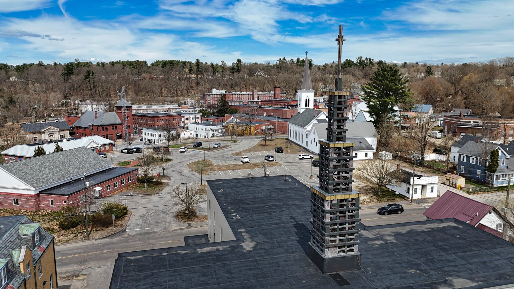
Layered view across downtown Franklin with a foreground rooftop cross and civic center beyond.
View Print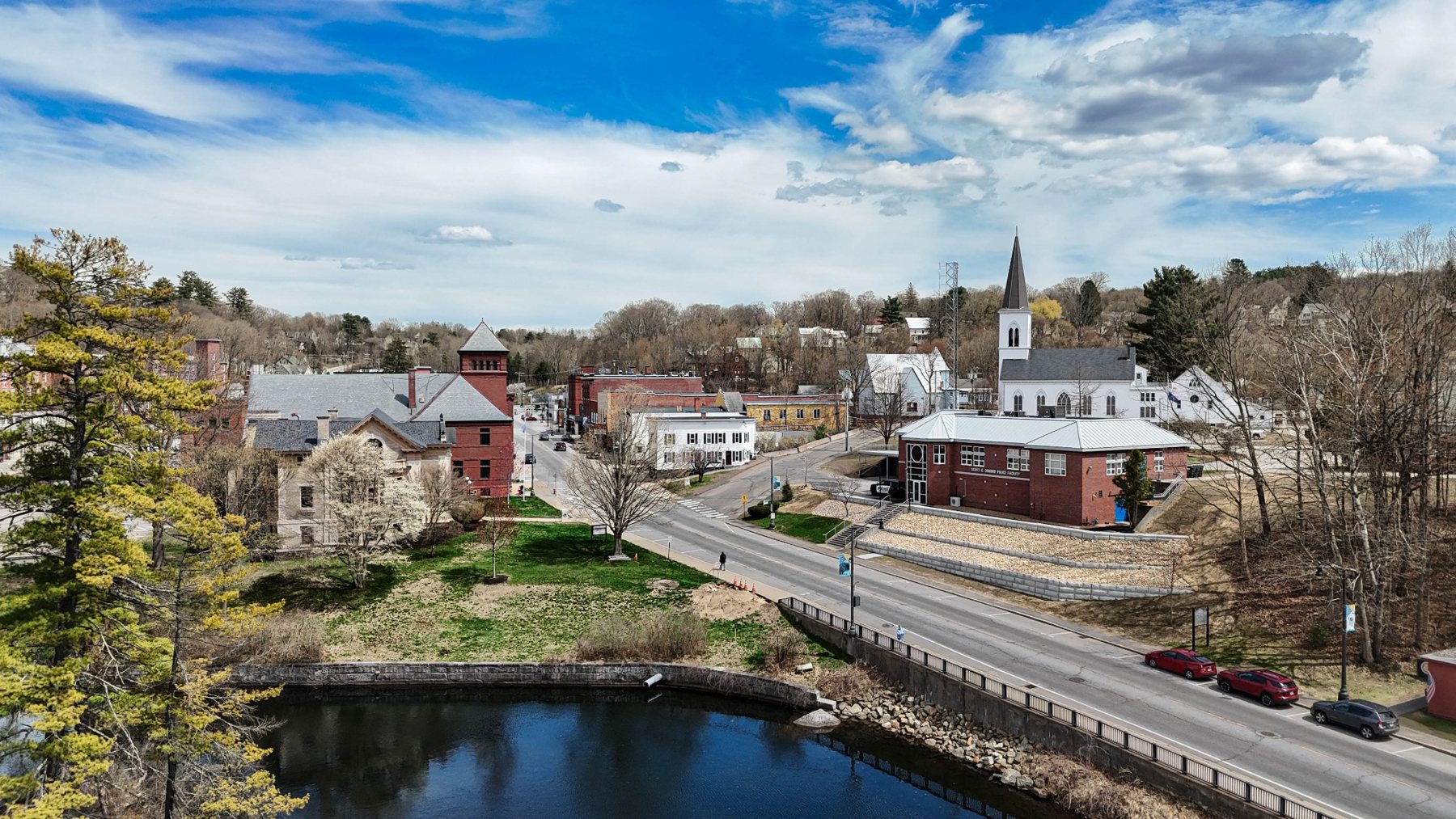
A tighter town portrait showing downtown Franklin, river edge, and civic architecture.
View Print
A broad aerial view of Franklin’s river corridor, neighborhoods, mill structures, and expansive sky.
View Print259-Town Archive
This town page is one entry in an ongoing effort to document New Hampshire communities from above.