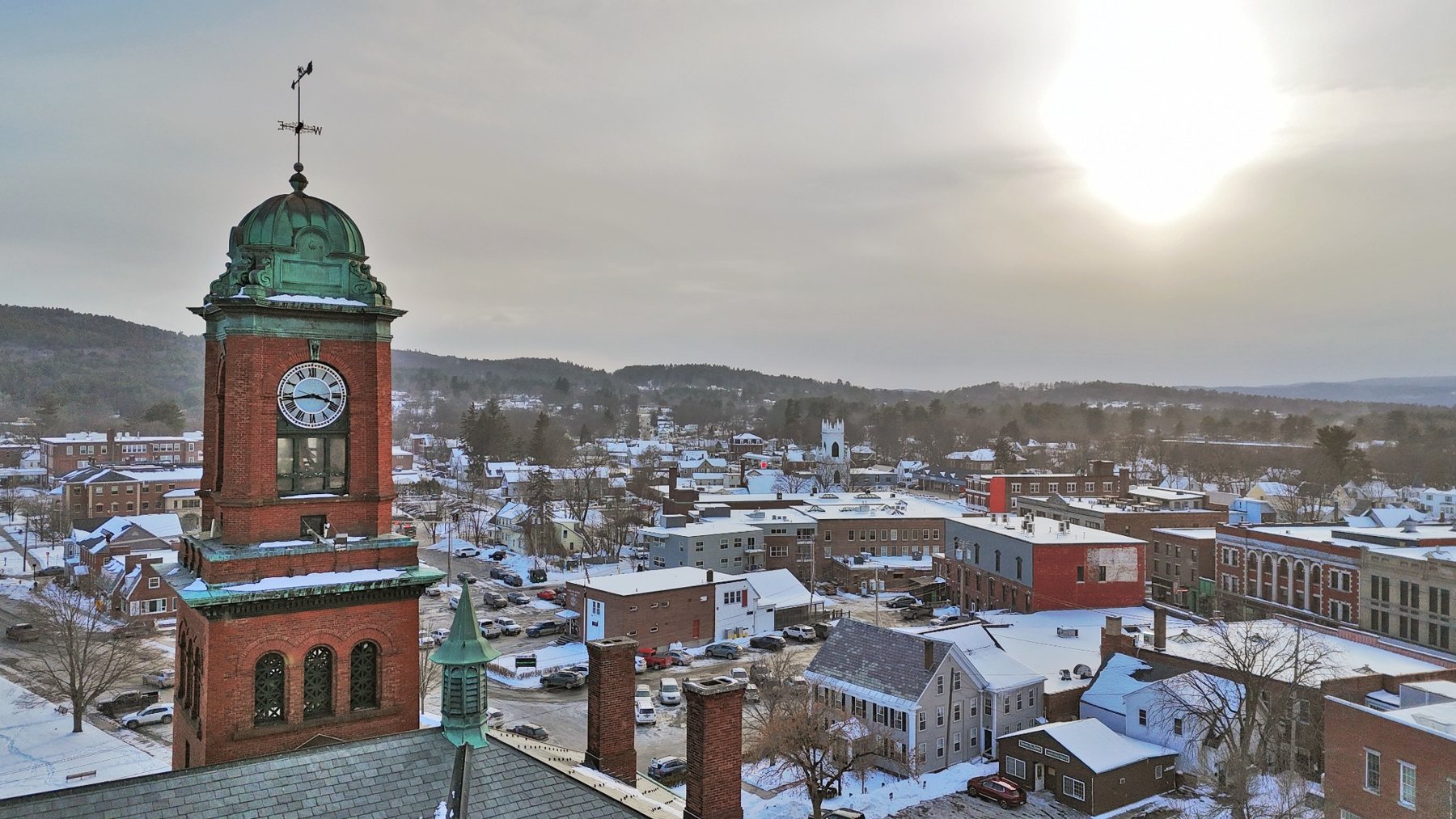
Clock Tower — Winter Sun
A dramatic winter aerial view with the clock tower anchoring downtown Claremont.
View Print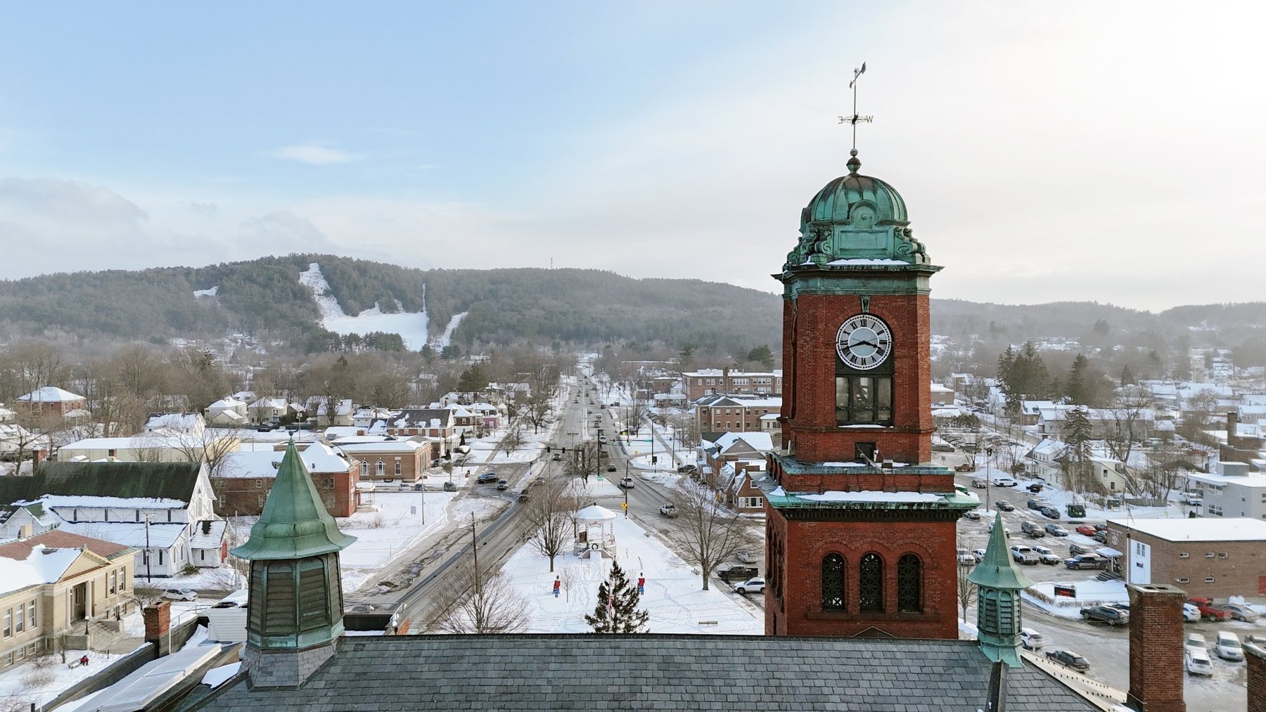
Sullivan County / Mill City
A historic western New Hampshire mill city shaped by the Sugar River, brick industrial architecture, winter rooftops, and one of the region’s strongest clock tower compositions.
Town Profile
A historic western New Hampshire mill city shaped by the Sugar River, brick industrial architecture, winter rooftops, and one of the region’s strongest clock tower compositions.
Part of Andri Kyrychok’s growing New Hampshire aerial town archive, this page is designed as both a visual record and a clean pathway to available print options.
Featured Images
A dramatic winter aerial view with the clock tower anchoring downtown Claremont.
View Print
The tower, winter rooftops, street line, and Arrowhead hillside form a clean civic portrait.
View Print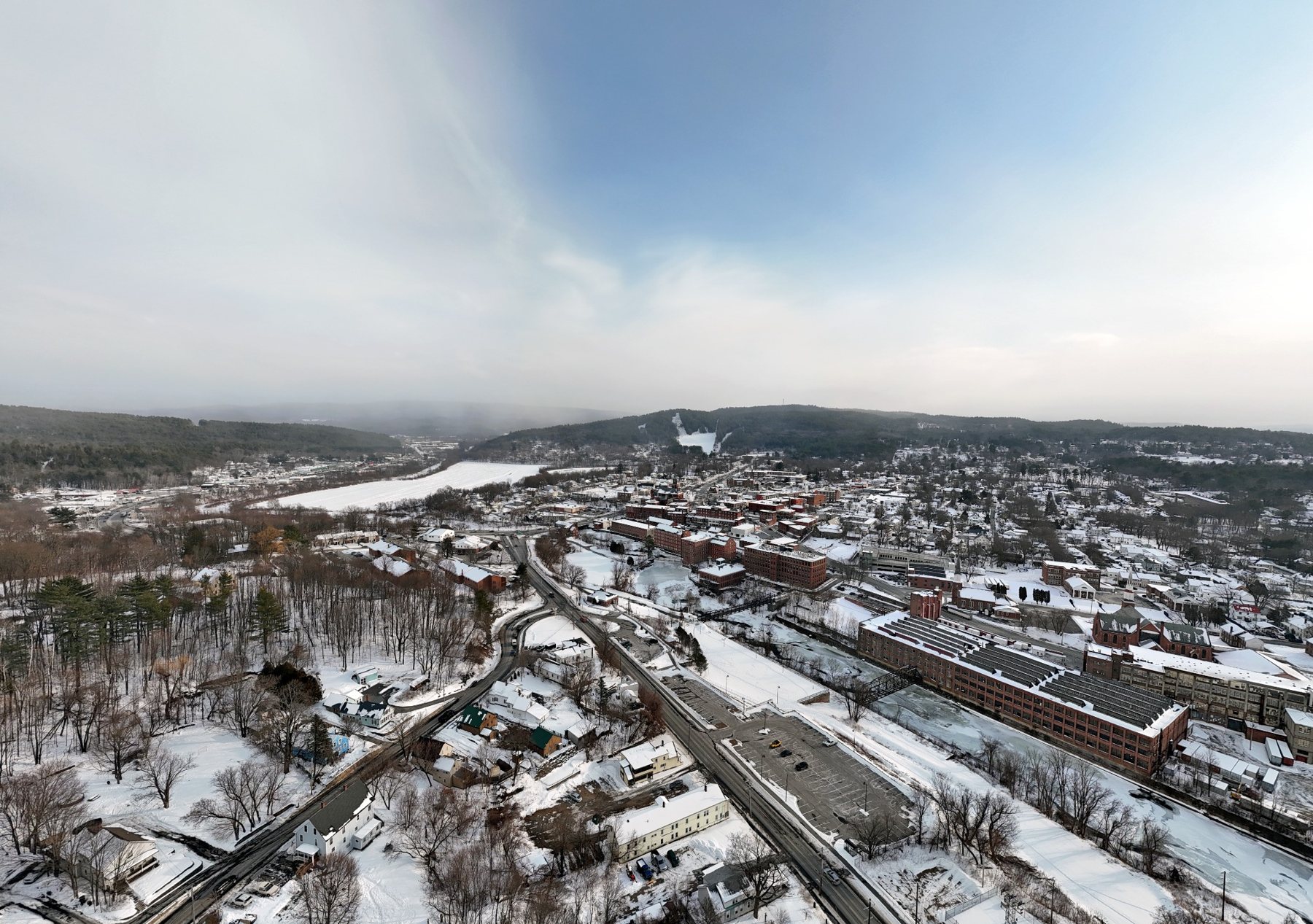
A wide aerial study of Claremont’s mill buildings, roadways, and surrounding terrain.
View Print259-Town Archive
This town page is one entry in an ongoing effort to document New Hampshire communities from above.